


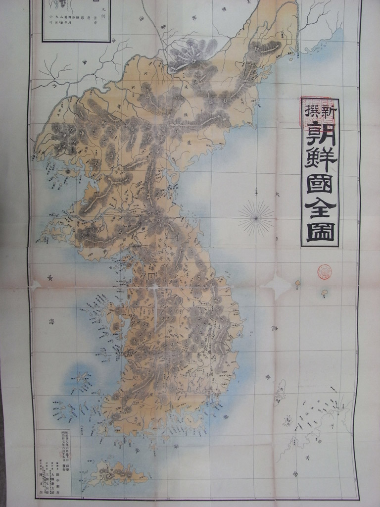
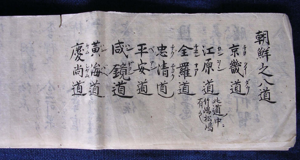
- 1894년, 일본인이 제작한 '신찬 조선국전도', 울릉도와 독도가 한국땅으로 그려졌다. 2011.09.23

- 1906년3월, 대한제국 정부는 지령 제3호를 발해 독도에 대한 일본의 영유권을 부정.. 2011.09.23
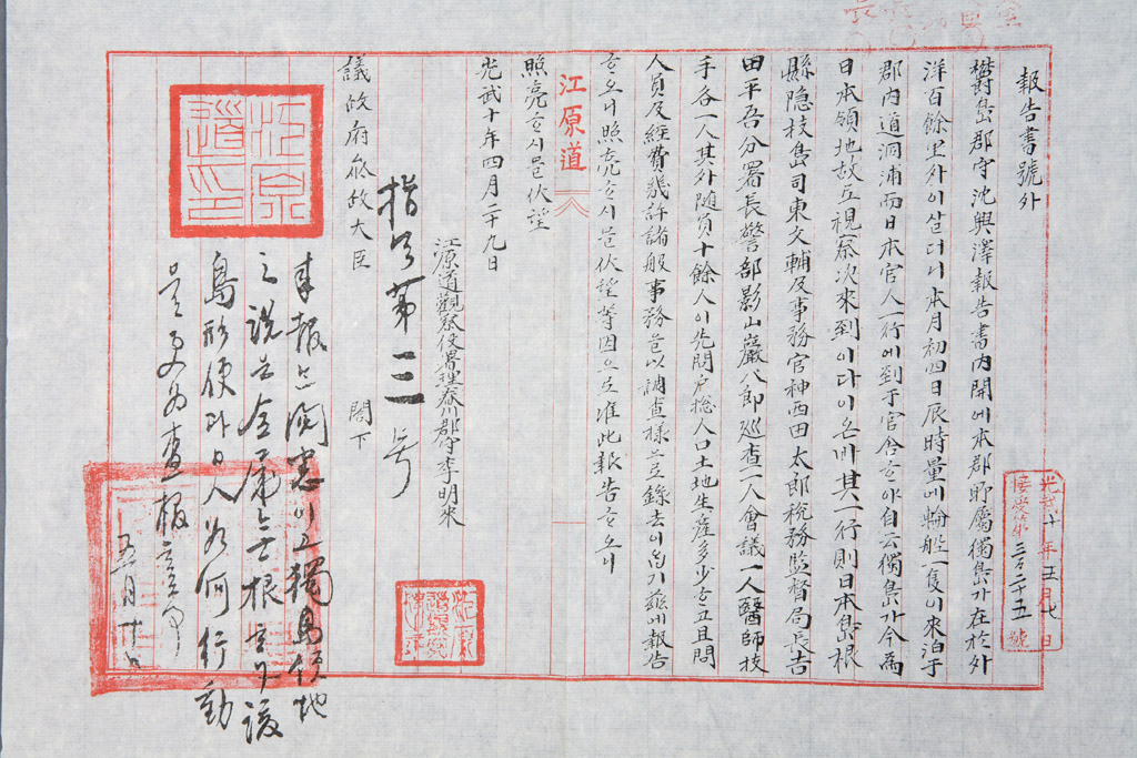
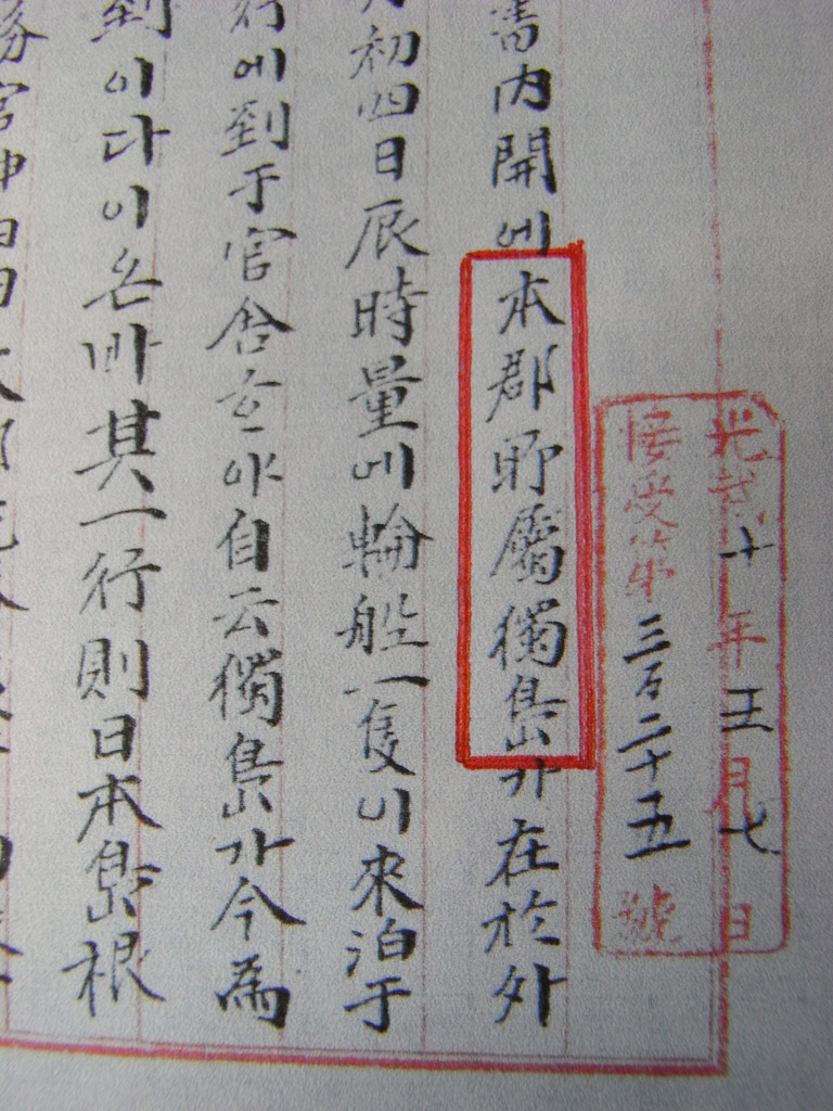
- 1906년 3월, 울도군수 심흥택이 '본군 소속 독도'가 일본에 편입되었다고 강원도에 보고. 2011.09.23
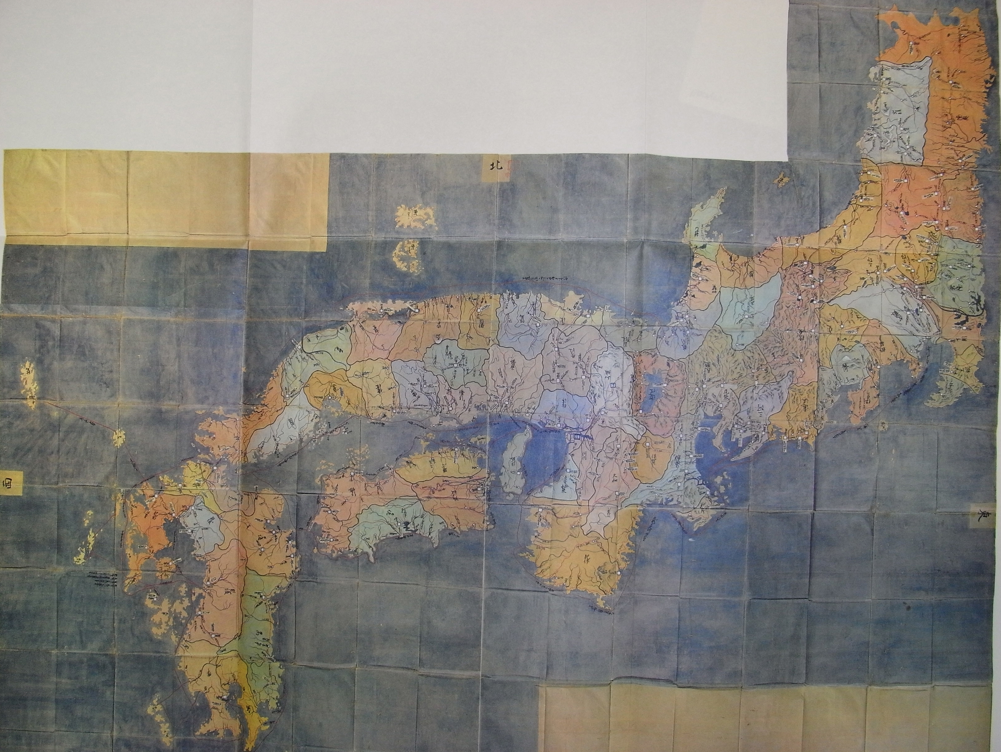
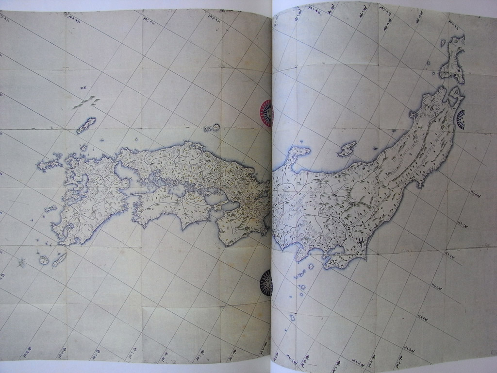
- 대일본연해여지전도(1821) : 에도막부 마지막의 공식일본전도. 2011.09.23
- 겐로쿠일본도(1712) : 일본에도막부 세번째 공식일본전도, 독도는 제외되었다. 2011.09.23
- 안용복이 울릉도(죽도)와 독도(송도)가 강원도에 속한다고 주장 2011.09.23
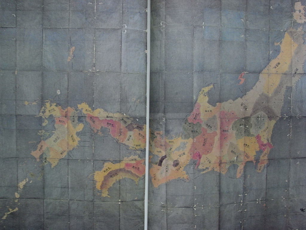
- 쇼호일본도(1655) : 에도막부 두번째 공식일본전도 : 서쪽 일본부분, 2011.09.23
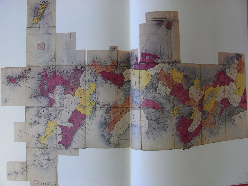
- 게이초일본도(1612) : 일본 에도막부 최초의 공식일본전도(독도는 제외되었다) 2011.09.23